正在加载图片...
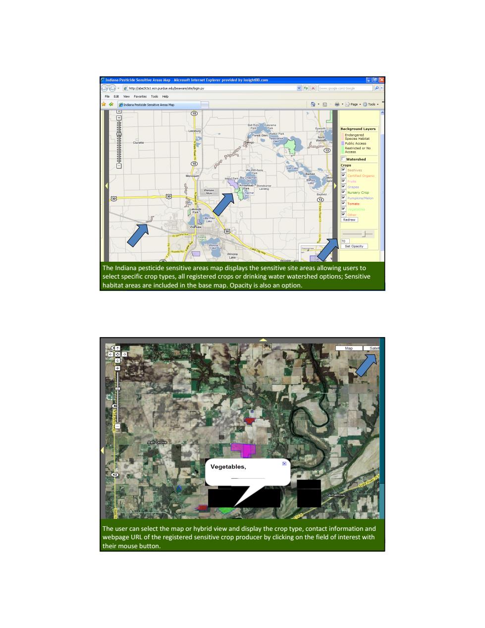
diana p icide sensitive areas map displays the sensitive site areas all g users to ned options The Indiana pesticide sensitive areas map displays the sensitive site areas allowing users to select specific crop types, all registered crops or drinking water watershed options; Sensitive habitat areas are included in the base map. Opacity is also an option. The user can select the map or hybrid view and display the crop type, contact information and webpage URL of the registered sensitive crop producer by clicking on the field of interest with their mouse button