正在加载图片...

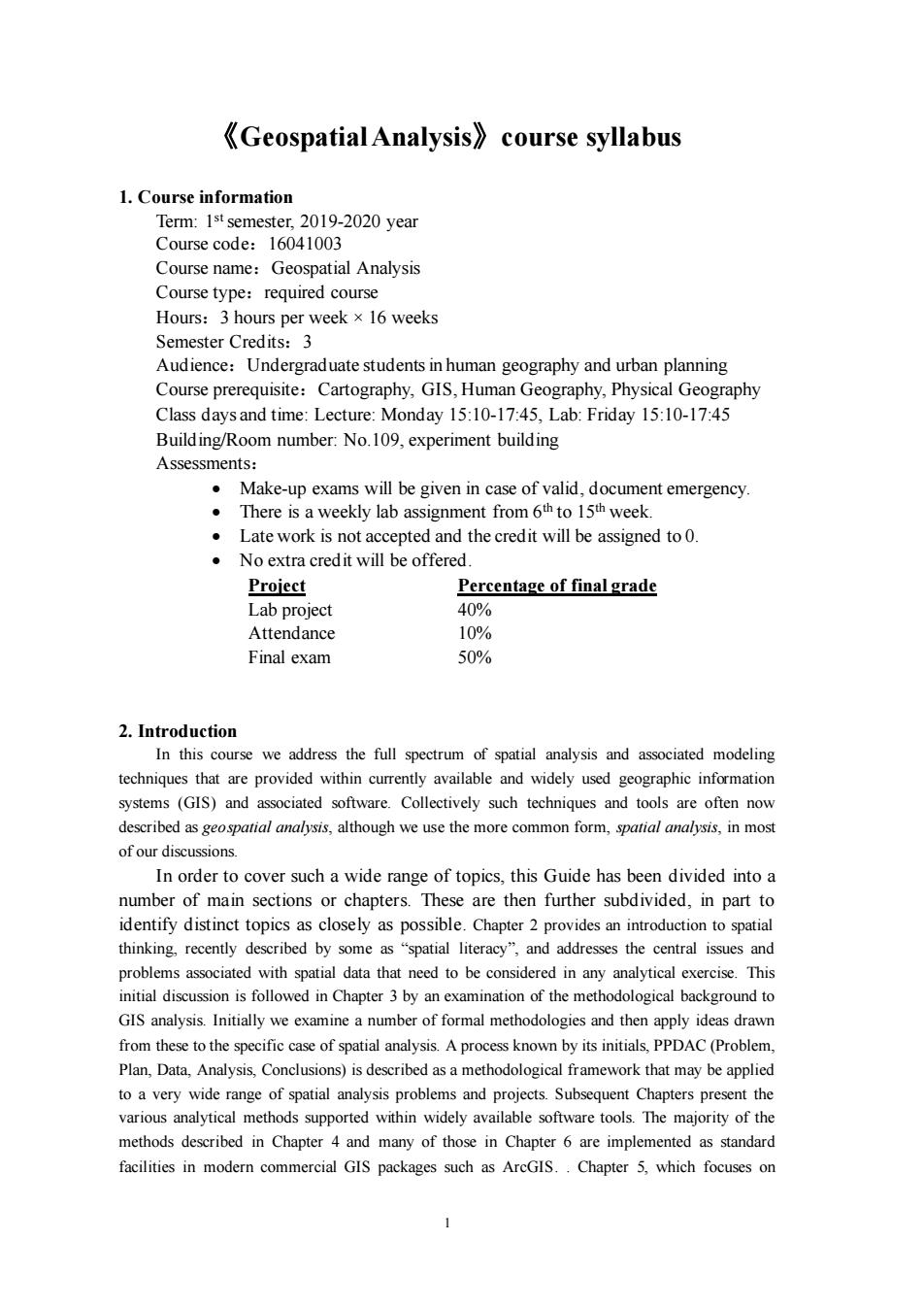
《Geospatial Analysis》course syllabus 1.Course information Term:1st semester,2019-2020 year Course code:16041003 Course name:Geospatial Analysis Course type:required course Hours:3 hou rs per week×l6 weeks Semester Credits:3 Audience:Undergraduate students in human geography and urban planning Course prerequisite:Cartography,GIS,Human Geography,Physical Geography Class daysand time:Lecture:Monday 15:10-1745 Lab:Friday 15:10-17:45 Building/Room number:No.109,experiment building Assessments. Make-up exams will be given in case of valid,document emergency. There is a weekly lab assignment from 6th to 15th week. Late work is not accepted and the credit will be assigned to 0. No extra credit will be offered Project Percentage of final grade Lab project 40% Attendance 106 Final exam 50% 2.Introduction In this course we address the full spectrum of spatial analysis and associated modeling techniques that are provided within currently available and widely used geographic information systems (GIS)and associated software.Collectively such techniques and tools are ofen now ibed as geopatial we use the alysis,in mos of our discussions In order to cover such a wide range of topics.this Guide has been divided into a number of main sections or chapters.These are then further subdivided,in part to identify distinct topics as closely as possible.Chapter 2 provides an introduction to spatial thinking.recently de as the c tral is ciated ith spatial data that need to b e con in any analytic exercise n is followed in Chapter 3 by an examination of the methodological background to GIS analysis.Initially we examine a number of formal methodologies and then apply ideas drawn from these to the specific case of spatial analysis.A process known by its initials.PPDAC (Problem. Plan,Data,Analysis,Conclusions)is described asa m ethodolo gical framework that may be applied to a very ange of spatial analysis proble and pters present t various anaytical methods supported within widely available sofware tools .The majority of the methods described in Chapter 4 and many of those in Chapter 6 are implemented as standard facilities in modern commercial GIS packages such as AreGIS..Chapter 5,which focuses on 1 《Geospatial Analysis》course syllabus 1. Course information Term: 1 stsemester, 2019-2020 year Course code:16041003 Course name:Geospatial Analysis Course type:required course Hours:3 hours per week ×16 weeks Semester Credits:3 Audience:Undergraduate students in human geography and urban planning Course prerequisite:Cartography, GIS, Human Geography, Physical Geography Class days and time: Lecture: Monday 15:10-17:45, Lab: Friday 15:10-17:45 Building/Room number: No.109, experiment building Assessments: • Make-up exams will be given in case of valid, document emergency. • There is a weekly lab assignment from 6th to 15th week. • Late work is not accepted and the credit will be assigned to 0. • No extra credit will be offered. Project Percentage of final grade Lab project 40% Attendance 10% Final exam 50% 2. Introduction In this course we address the full spectrum of spatial analysis and associated modeling techniques that are provided within currently available and widely used geographic information systems (GIS) and associated software. Collectively such techniques and tools are often now described as geospatial analysis, although we use the more common form, spatial analysis, in most of our discussions. In order to cover such a wide range of topics, this Guide has been divided into a number of main sections or chapters. These are then further subdivided, in part to identify distinct topics as closely as possible. Chapter 2 provides an introduction to spatial thinking, recently described by some as “spatial literacy”, and addresses the central issues and problems associated with spatial data that need to be considered in any analytical exercise. This initial discussion is followed in Chapter 3 by an examination of the methodological background to GIS analysis. Initially we examine a number of formal methodologies and then apply ideas drawn from these to the specific case of spatial analysis. A process known by its initials, PPDAC (Problem, Plan, Data, Analysis, Conclusions) is described as a methodological framework that may be applied to a very wide range of spatial analysis problems and projects. Subsequent Chapters present the various analytical methods supported within widely available software tools. The majority of the methods described in Chapter 4 and many of those in Chapter 6 are implemented as standard facilities in modern commercial GIS packages such as ArcGIS. . Chapter 5, which focuses on