正在加载图片...
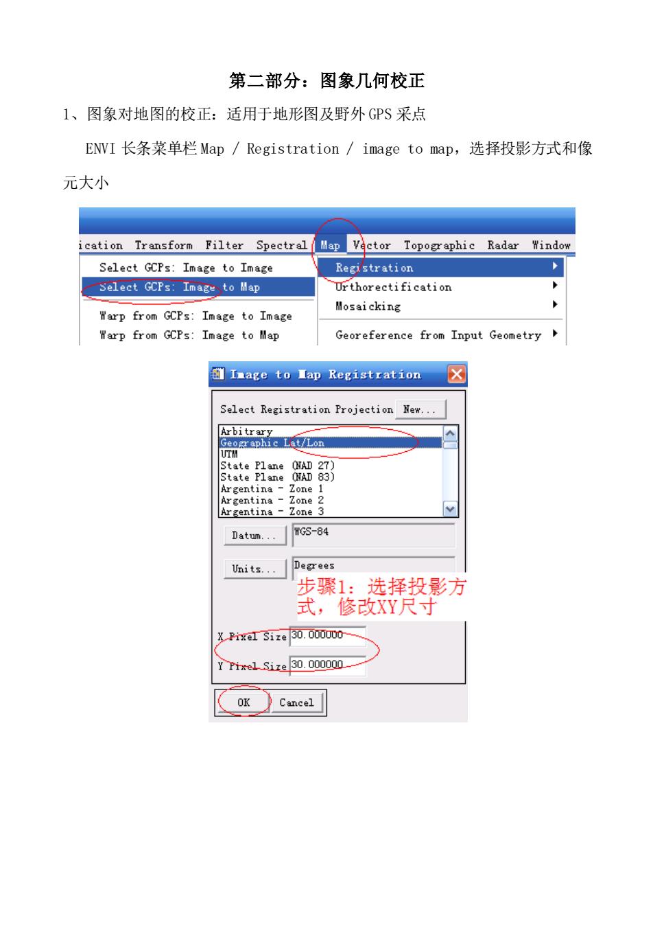
第二部分:图象几何校正 1、图象对地图的校正:适用于地形图及野外GPS采点 ENWI长条菜单栏Map/Registration/image to map,选择投影方式和像 元大小 ication Transform Filter Spectral Vector Topographic Radar Window Select GCPs:Image to Image Registration Select GCPs:Image to Map Urthorectification Warp from GCPs:Image to Image Mosaicking Warp from GCPs:Image to Map Georeference from Input Geometry Image to Ia即Registration☒ Select Registration Projection New. Arbitrons LovLon Datum.WG5-84 Units.Deerees 步骤1:选择投影方 式,修改XY尺寸 XPixel Size30.000000- Tr1e1Sixa30.000000 OK Cancel第二部分:图象几何校正 1、图象对地图的校正:适用于地形图及野外 GPS 采点 ENVI 长条菜单栏 Map / Registration / image to map,选择投影方式和像 元大小