第七章 P R 遥感图像分类 1
1 第七章 遥感图像分类 UESTC-RSIP
专题分类 A thematic map shows the spatial distribution of identifiable earth surface features;it provides an informational description over a given area,rather than a data description. Image classification is the process used to produce thematic maps from imagery.The themes can range, for example,from categories such as soil,vegetation, and surface water in a general description of a rural area,to different types of soil,vegetation,and water depth or clarity for a more detailed description. 2
2 专题分类 A thematic map shows the spatial distribution of identifiable earth surface features; it provides an informational description over a given area, rather than a data description. Image classification is the process used to produce thematic maps from imagery. The themes can range, for example, from categories such as soil, vegetation, and surface water in a general description of a rural area, to different types of soil, vegetation, and water depth or clarity for a more detailed description. UESTC-RSIP

Thematic maps (Rondonia,Brazil) Altitude(m) Current vegetation 8 10 11 .11 12 -12 -13 -13 -54 -83 62 51 80 86 84 -63 -62 61 60 Longttude (degrees) Longttude (degrees) 3
3 Thematic maps (Rondonia, Brazil ) UESTC-RSIP
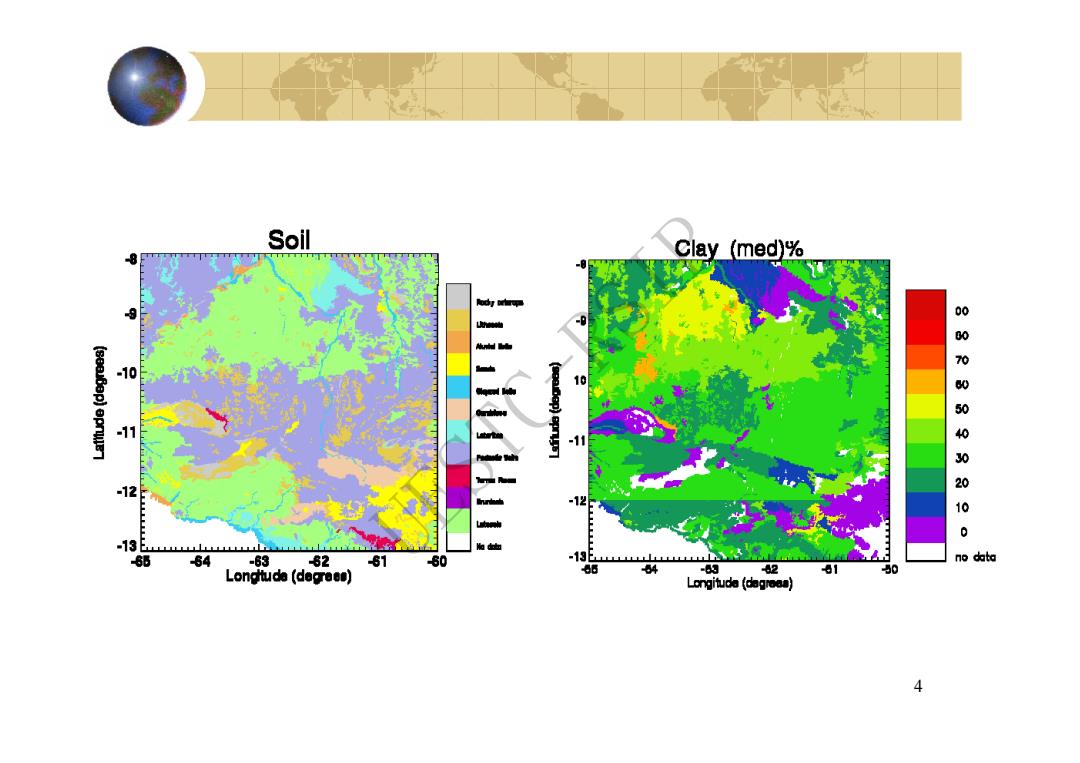
Soil -8 Clay (med)% 10 -12 000WS00000 -12 : -13 6 64 -63 82 81 60 -13 no data Longtuda (degrees) 64 -63 2 81 Longituda (dagroas) 4
4 UESTC-RSIP
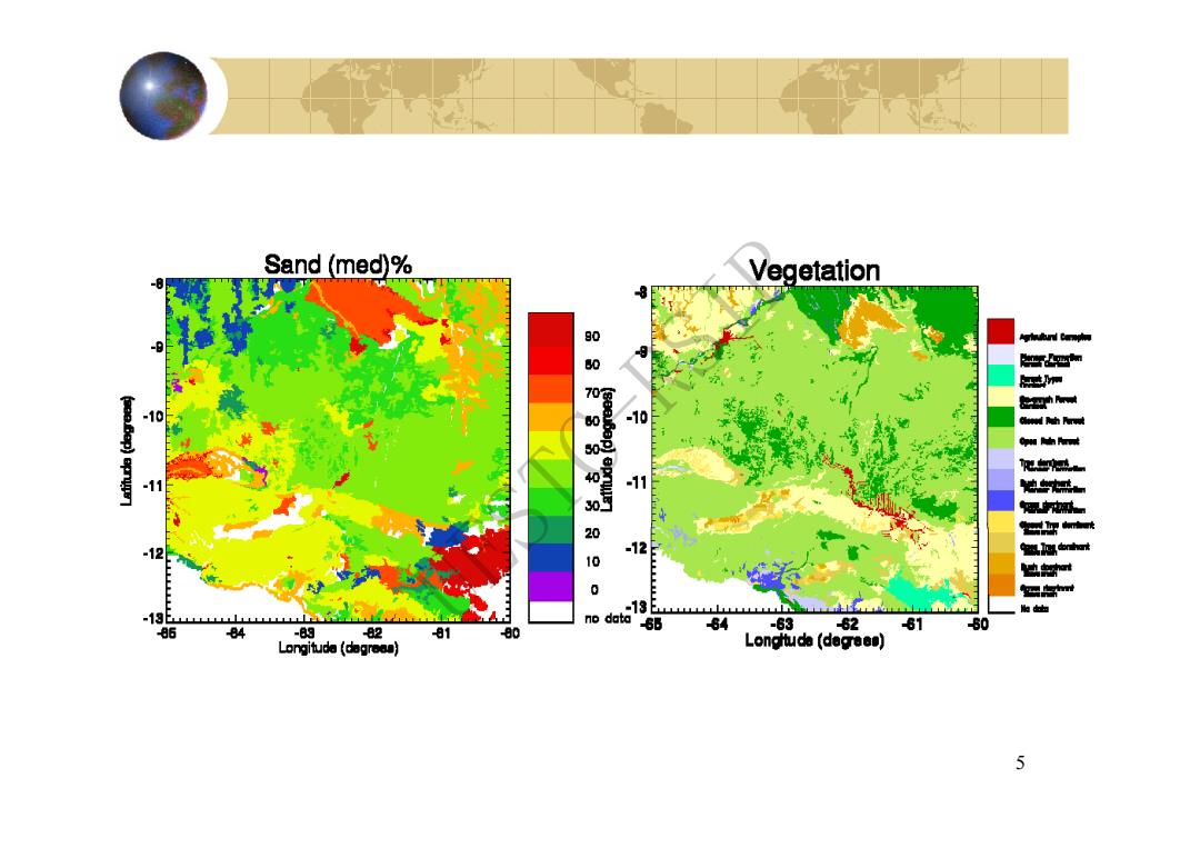
Sand (med)% Vegetation 80 0 -10 11 -12 0 -13 no 13 dat 50 86 84 -8g 82 81 80 84 -63 62 81 Longitude (dogresa) Longttuda (decrees) 5
5 UESTC-RSIP

40 00 NORTH OCEAN NORTH ATLANT Troolc of Cancer Tropic of Caoricarn U PACIRC OCEA Antarctic Circle Soil Types Alfisols:gray to brown surtace soils, Inceptisols:weaky developed immature soils, Uissols:acidic and clayey soils of upland tropical medium to high base nutrients and organic content typically tundra or volcanic soils savannas:medium base nutrients Andisols:dry or desert soils:high in Mollisols:thick.dark soils of tallgrass praines; Vertisois:clay soils of moist tropical savannas: base nutrients and low in organic content high in organic content and base nutrients tend to crack and swell when dry Entisols:soils with poorty deveioped layers Oxisols:tropical and subtropical highly Mountain sois:thin sois,tending toward acidic: typically wind-deposited soils weathered soils:low in organic and base nutrients miced vareties based on vertical zonation Histosols:swamps and bog soits:wet,highly L相a or no soil orgsnic (peat and muck)content high in organic content and low in base nutrients
6 UESTC-RSIP
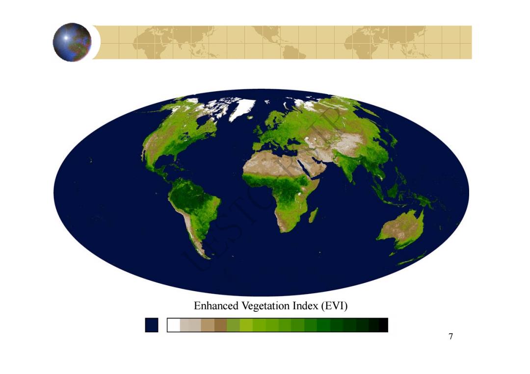
Enhanced Vegetation Index(EVI) 7
7 Enhanced Vegetation Index (EVI) UESTC-RSIP

人工解译航片 730 217a Tabor Dake 2172X Tabor Lake 9171 主要依赖的地物属性有:形状、纹理、地物之间的相关性、颜色等 8
8 人工解译航片 主要依赖的地物属性有:形状、纹理、地物之间的相关性、颜色等 UESTC-RSIP

original image classified image Open Water Woody/Emergent Wetlands Grasslands/Herbaceous Pasture/Hay Deciduous/Evergreen Forest Row Crops/Small Grains/Fallow Bare Rock/Sand/Clay ResidentiaVIndustria
9 original image classified image Pasture/Hay Grasslands/Herbaceous Woody/Emergent Wetlands Open Water Residential/Industrial Bare Rock/Sand/Clay Row Crops/Small Grains/Fallow Deciduous/Evergreen Forest UESTC-RSIP

scene atmosphere sensor multispectral image classifer extraction 1 K-D feature image TC training K-D feature space determine select decision training pirels boundaries labeling Figure 9-1 the data flow in a b thematic classification process map
Figure 9-1 the data flow in a classification process UESTC-RSIP